Contact
+97142676170
Created by
Guest
Description
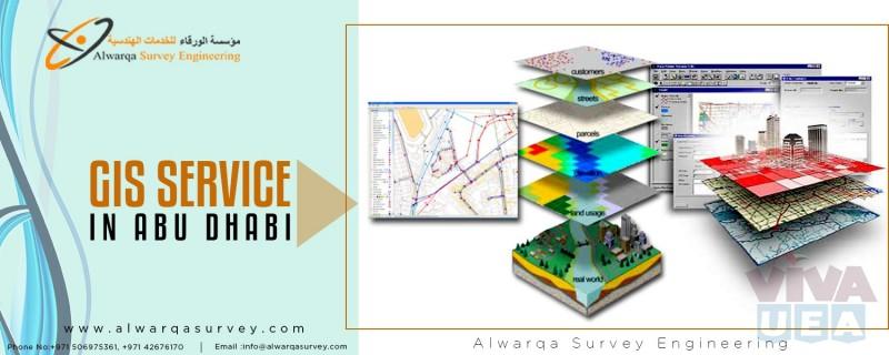
GIS software adds intelligence to spatial data, whether the info is generated within the field with GPS or remotely with lidar and photo grammetry. A geographic information system (GIS) is a system designed to capture, store, manipulate, analyze, manage, and present spatial or geographic data. Alwarqa Survey Engineering leverages the power of Geographic Information Systems (GIS) to analyze, manage, and display environmental data. We use GIS Service in 90% of our projects. Our GIS analyst are capable of capturing data from many different sources and in many different formats, including local, state, and federal datasets, aerial and satellite imagery, digital elevation models (DEMs), CAD drawings, KML & KMZ files, client files, and GPS data collection.
For More Details
Email Id:[email protected]
Phone no:-+97142676170
Website:- http://www.alwarqasurvey.com/gis-services-in-ras-al-khaimah
For More Details
Email Id:[email protected]
Phone no:-+97142676170
Website:- http://www.alwarqasurvey.com/gis-services-in-ras-al-khaimah
IMPORTANT!
Before you contact the advertiser, do a payment or make a deal, please read our SAFETY TIPS.
Help us and report scams, don't forget to read vivaUAE TERMS AND CONDITIONS.
Location
Al Qusais, Dubai
Damascus Street, Al Qusais Industrial Area 1 Office# 230, Deyaar Building Dubai AE - Damascus Street - Dubai - United Arab Emirates
Damascus Street, Al Qusais Industrial Area 1 Office# 230, Deyaar Building Dubai AE - Damascus Street - Dubai - United Arab Emirates
Advert details
Advert ID
140316
Displayed
97
Added
2020-01-22 20:28:48
Expires
never expire
Category
Engineering
UAE FREE CLASSIFIED ADS WEBSITE
vivaUAE provides high-response free classifieds and advertisements. All adverts must conform to our Technical Guidelines. We request all our users to report to us immediately if they come across any miscategorized, fraudulent, or suspicious ad.